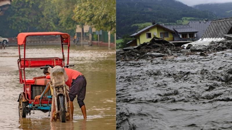
As summer approaches in India, anticipation often mingles with apprehension. While the monsoon rains are vital for agriculture and life, recent years have shown a worrying trend: an increase in extreme rainfall events (ERE). Think of the devastating floods and landslides, displacing millions and causing billions in damage. They have been attributed to off-the-charts deluges that turn streets into rivers and trigger landslides in a flash.
While we've gotten good at forecasting big ocean storms like tropical cyclones, predicting the frequency of these localised, hyper-intense rain bursts or EREs across large regions like Central or Northeast India during the monsoon season has remained a significant challenge. Until now, that seasonal forewarning was largely missing, leaving communities vulnerable.
Now, a team of researchers from the Academy of Scientific and Innovative Research (AcSIR) have set out to tackle this crucial gap. They wanted to see if they could reliably predict how often these extreme rainfall events (ERE) would happen across India months ahead. Their core idea was rooted in a fundamental understanding of the Indian monsoon: its strength and patterns aren't random. They're heavily influenced by massive, slow-moving temperature shifts and circulations in the tropical oceans, a phenomenon linked to El Niño-Southern Oscillation (ENSO). When they study such phenomenon across all three tropical basins, Pacific, Indian, and Atlantic, the phenomenon is termed Global ENSO or G-ENSO.
The G-ENSO system is like a battery in the tropical oceans, storing and releasing heat and energy in complex ways, driving global weather patterns, including the Indian monsoon. The researchers hypothesised that the frequency of EREs, essentially super-charged monsoon rain events, must also be tied to this same massive oceanic engine. They focused on a key indicator of this engine's state: the depth of the ocean layer where the temperature hits 20°C (called D20). Changes in this depth across the tropical oceans act like a fuel gauge or an internal temperature reading for the G-ENSO system.
The researchers set out to find if they could predict the seasonal ERE frequency using this D20 indicator under ideal conditions. They created a predictor based on the historical relationship between D20 patterns and ERE frequency over decades. They found that the potential predictability, or how well the D20 theoretically aligns with ERE frequency, was higher when looking many months ahead (5 to 22 months) than when looking just one to four months ahead of the monsoon season.
This short-lead difficulty is a known challenge in climate forecasting, sometimes called the spring predictability barrier. Rapid changes and more 'noise' in the coupled ocean-atmosphere system make forecasts initiated just before the monsoon season particularly tricky. The slower, more predictable ocean signals dominate at longer leads, offering a more transparent window. While not a real forecast since it used information from the future in its setup, this initial test showed that the underlying physical connection existed and that prediction was possible.
The challenge, of course, is making a forecast, without the benefit of perfect knowledge. They tried a straightforward approach first, using a linear model to predict ERE frequency based on the D20 data available months before the monsoon. But this simple model failed dramatically when tested on independent years it hadn't seen before. The relationship between the D20 patterns and extreme rain frequency isn't a simple straight-line causation but instead is much more complex, with subtle, non-linear connections and smaller-scale patterns that change year to year. A simple linear tool just couldn't capture these nuances.
The researchers then turned to artificial intelligence, specifically a deep learning model called a Convolutional Neural Network (CNN). CNNs are excellent at finding intricate patterns in complex data, like the spatial patterns of D20 across the oceans. To teach this engine the complex rules of the climate system, they trained it using a vast amount of simulated climate data from global climate models like CMIP6.
While imperfect, these models provided a huge 'flight simulator' of different climate scenarios, showing the CNN how tropical ocean patterns, represented by the D20 maps, influence extreme rainfall over many different historical periods. Crucially, they didn't just feed it one month's D20 data but the D20 patterns from eight months up to the monsoon season. This 'evolutionary history' helped CNN understand how the G-ENSO signal develops over time and shapes the later rainfall extremes.
When tested on independent real-world data from recent decades (1992-2022), the CNN achieved significant skill in forecasting seasonal ERE frequency and Extreme Rainfall Activity (ERA), a measure of the amount of rain in extreme events, one month in advance. Its forecasts matched observations much better than the simple linear model, and it showed a strong ability to distinguish between years with above-normal, normal, and below-normal extreme rain frequencies.
The model successfully predicted most major years with widespread extreme rain events over the test period. The researchers even used techniques to peek inside the 'brain' of the CNN. They confirmed that it was indeed learning and using the D20 patterns across all three tropical oceans – just as their G-ENSO hypothesis predicted – to make its forecasts. The model isn't perfect, as it misclassifies some years, and the training data from climate models have limitations like lower resolution. Nevertheless, this is the first demonstration of seasonal forecasting for this critical weather event.
Extreme rainfall events are increasing in frequency and intensity owing to climate change, posing an ever-greater threat to life, infrastructure, and food security in vulnerable regions like India. A skilful seasonal forecast, even one month ahead, provides invaluable lead time. It allows governments, disaster management agencies, and communities to prepare. This ability to anticipate the monsoon's fury means the difference between being caught off guard by a disaster and being able to mitigate its worst impacts, saving lives and reducing the mounting economic toll of climate change.
This research article was written with the help of generative AI and edited by an editor at Research Matters.


